New to Sudbury?
If you are planning to purchase a home in Sudbury, get to know it a bit better. If you are interested in custom new home construction, click here.
Downtown
The Downtown of Sudbury includes one of the city’s largest concentration of retail businesses and offices.
The downtown core was the city’s original neighbourhood, features the Rainbow Centre, government offices at the Tom Davies Square, the Sudbury Theatre Centre. Market Square, a farmers’ and craft market, streetscape beautification projects, and the creation of the Downtown Village Development Corporation, a not-for-profit organization that identifies and pursues development opportunities. The city is in existence today because of the construction of the rail in this area of the province.
Flour Mill
The Flour Mill neighbourhood, immediately north of downtown Sudbury, The residential area Mont-Brébeuf with Collège Notre-Dame is part of this neighbourhood. In French, the community is known as le Moulin-à-Fleur. It is the French Quarter of the city., the Flour Mill was historically settled by Franco-Ontarian farmers and labourers.
The residential Cambrian Heights neighbourhood extends northward from the Flour Mill along Cambrian Heights Drive. Collège Boréal and its campus is in this area. The Flour Mill includes commercial development along the main arterial road Notre Dame and consists of mostly older single family residences and small Multi-Family.
Bell Park | Hospital Area
The Bell Park neighbourhood, more commonly referred to as the Hospital area, One of the oldest neighbourhoods in the city with homes dating from the late 1800s to the 1940s. The Bell Park itself is part of his former estate land, donated to the city by the family in 1926 and hosts the finest beaches in downtown Greater Sudbury.. The boardwalk connecting the park to the nearby Science North site, along the Lake Ramsey shoreline. Other notable buildings in this area include the Water Pumping Station/Hydro Building, the former Residence of the President of Laurentian University, the former Residence of the Grey Nuns, Science North , the Sudbury Yacht Club on Blueberry Island, Idylwylde Golf & Country Club, Health Sciences North (Hospital) and Laurentian University. This area os of high demand when it comes to Real Estate, includes wide range of Single Homes and small Muilti-Family. Area also consists of Single Family Homes of the victorian era that have been refurbished.
New Sudbury
The New Sudbury area, centred on Lasalle Boulevard running east-west and Barry Downe Road running north-south. The area includes a mix of commercial development along Lasalle, such as the New Sudbury Centre, the largest shopping mall in Northern Ontario and residential properties on most of its streets. This community is home to the Adanac Ski Hill, Rotary Park and as well as Timberwolf Golf Course and Cambrian College. Area consists of mostly single family Residences starting from the 50’s, 60’s with continued development of homes throughout the 70’s, 80’s and 90’s to the current time!
South End
The South End of Sudbury includes the urban neighbourhoods of Robinson, Lockerby, Moonglo and Lo-Ellen. The centre of the area is the Four Corners, a major commercial shopping district centred on the intersection of Regent Street, Paris Street and Long Lake Road. The Southridge Mall, located on the southeast quadrant of the Four Corners.
The South End is currently one of the fastest-growing areas of the city, with significant commercial and residential development taking place especially in the Algonquin Road area and Long Lake Road with the most recent commercial Power Centre that includes WalMart and other large retailers.
Highway 17, the main route of the Trans-Canada Highway, passes through the South End along the Southwest Bypass.
The more rural McFarlane Lake and Long Lake areas may also be grouped with the South End, or may be treated as distinct neighbourhoods.
Area consists of many newly developed subdivisions of single family dwellings and as well homes from as early as the 50’s, also large multi-family builidngs.
West End
The West End is the area located immediately west of downtown. Primarily residential in character, with some commercial areas within, the neighbourhood is centred on the intersection of Regent and Victoria Streets, it is home to Queens Athletic Park, with its track & field oval that becomes a skating oval over the winter. Area consists of single family dwellings and small multi-family with some commerical small businesses along Regent Street.
Minnow Lake
Minnow Lake one of the older residential areas in the former city is centered on Howie/Bellevue/Bancroft Drives between the Kingsway (Municipal Road 55/Hwy 17 Trans-Canada) and the north shore of Ramsey Lake, west to Moonlight Avenue. The small lake known as Minnow Lake can be seen from Bancroft Drive, Bellevue Street and Howie Drive,. Minnow Lake has is home to the Sudbury Curling Club, Carmichael Arena and its skateboard park, the Civic Memorial Cemetery. There are also scenic trails around the lake and up the nearby rocky hills both at Blueberry Hill and Oak Forest. There are three elementary schools in Minnow Lake: Adamsdale Public School, Pius XII Catholic School and École St-Pierre. Area consists of single family residences and small mulit-family and a mix of commercial businesses along Howie, Bellevue and Bancroft Drive.
Donovan | Northern Heights
Centred on Frood Road northwest of downtown, Donovan refers to the area immediately surrounding the intersection of Frood, Kathleen and Beatty, the subdivision was built in the 1930s.. After WWII, the area was settled by many European immigrants, mainly from Ukraine, Poland, Finland and the former republic of Yugoslavia. Each of these ethnic groups founded community halls in the Donovan. Area consists of single family residences, small and medium multi-family complexes.
Gatchell
This area is south west of downtown, nestled between the West End of Sudbury and the town of Copper. Built mostly in the 1920s through 1940s. There are a large number of rental apartments in the area, but mostly is composed of single family residences, commerical and industrial development along the main arterial road Lorne Street. (Hwy 17W) Trans-Canada Hwy.
The community has four public elementary schools and three Catholic elementary schools.
The age of the community has provided a number of smaller shops and services conveniently scattered throughout its own commercial district mainly along Lorne Street. There are several large commercial and light industrial business as well.
The community is home to the Gatchell indoor swimming pool. The Junction Creek in this area is undergoing a transformation as the Trans-Canada Trail is being constructed through the vacant lands along its banks. The neighbourhood’s primary features are the Big Nickel numismatic monument park with its Dynamic Earth Center and ‘Delki’ Dozzi Park, a park and sports complex that defines almost the entire northern boundary of the neighbourhood. The park was named after a prominent Italian-Canadian, local politician, Delchi Dozzi.
Copper Cliff
Copper Cliff, an area centred on Godfrey Drive and Creighton Road running south to Regional Road 55.
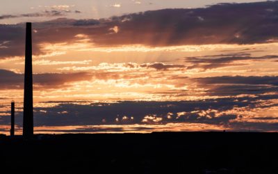
Vale’s (Inco) operations in the city are headquartered in the Copper Cliff area. Most notably, Copper Cliff is the location of the Vale Superstack,, the tallest chimney in the Western Hemisphere, which towers over Vale’s main smelter facility.
A local community museum, the Copper Cliff Museum, is located on the site of the very first homestead in what is now Copper Cliff.
This area also includes the micro neighbourhood of Little Italy nestled at the base of the Vale Superstack, centred on Diorite Street and Craig Street. The Societá italiana di Copper Cliff (Italian Club) is one of the oldest social clubs in the area. Area also consists of typically well kept single family dwellings, some of victorian style and also 50’s & 60’s.
Nickel Centre
Most of the communities in Nickel Centre originally started as settlements for small lumber and logging camps. The Canadian National Railway was built to go through these communities in the early 1900’s in order to assist with the transportation of workers and logging materials. Mining has also been a big part in this community as significant ore bodies were discovered. The community of Nickel Centre comprises of Coniston and Whanapitae which both border Hwy 17 E, Garson which is the hub of Nickel Centre and is home to Garson Mine which now is Vale. The town of Falconbridge where a major logging company Gervais Lumber still runs their family run business and also the Falconbridge Mine site, which is now Glencore. And also the town of Skead which was the sawmill community for many years, Poupore Lumber collected timbers from Wanapatei/ Matagamasi Lake area and was the base camp for most logging settlements in the area. Today this community hosts both of the mining companies Vale & Glencore with their large ore bodies.
Valley East
Over time, the settlements grew into the villages known as Hanmer, Val Therese, Val Caron, Blezard Valley, Guietteville, and McCrea Heights. In 1998 these communities were officially incorporated as the City of Valley East.
Capreol
Capreol has come along way from its early roots as a railway junction for the Canadian Northern Railway.
The Town of Capreol has developed into a thriving, close-knit community that celebrates its heritage and honours the people who have helped to make the town what it is today.
Although part of the City of Greater Sudbury, Capreol is truly its own town.
Rayside Balfour
What began with the arrival of the Canadian Pacific Railway workers, initiating the economic activity of the region. Pastors of various beliefs came to serve the community and religious life was organized. Church and language were at the heart of the development of education in the Townships of Balfour and Rayside. The parish became the centre of social activities and many sporting events. These separate townships organized themselves into municipalities. Azilda, Chelmsford, Creighton and Morgan.
Onaping Falls
Onaping Falls is three local communities: Dowling, Onaping and Levack. The area is know for its recreational abundance; fishing, hunting, snowmobiling, cross-country skiing and downhill skiing and most other recreational sports are common activities of the residents. It has become famous for High Falls, where the Onaping River drops 46 meters in a single plunge. Dowling‘s history began with arrival of farmers who purchased land and cleared it themselves, it is also know as the hub of Onaping Falls. Levack stood out for the creation of the jitney (Taxi, which used the railbed as a convenient method of transportation between the town and the main railway line was needed for the workers and their families.) Onaping began as a company mining town that many thought wouldn’t last, quickly grew to become a permanent settlement, and still hosts both mining giants today, Vale & Glencore.
Walden
Looking For a Custom Home?
If you’re thinking of having a custom home built with exquisite internal/external architecture, distinguished for luxury and comfort, look no further. Contact us at 705-560-2323 to discuss, you may bring your own plans, sketches, etc., otherwise we can provide you with a wide range of custom designs or you may choose to meet our home designers to assist with the new Home plans!
You have the option of choosing from a list of suggested reputable local Home Builders that provide our clients with knowledge and excellent craftsmanship. Working with traditional methods as well as modern finishes that make these custom homes stand-out and unique! Whatever your dream home may be or whatever you may want it to be, we can help make it a reality! Get in touch today.

Here for all your real estate needs.


